Highlight: May–August 2024 publications using OpenTopography datasets
by Emily Zawacki
OpenTopography periodically highlights new research results that demonstrate the use and reuse of data from OpenTopography. These three publications highlight topographic research applications in fault geomorphology, botany, and ecology and wildlife management.
Fault mapping with drone lidar
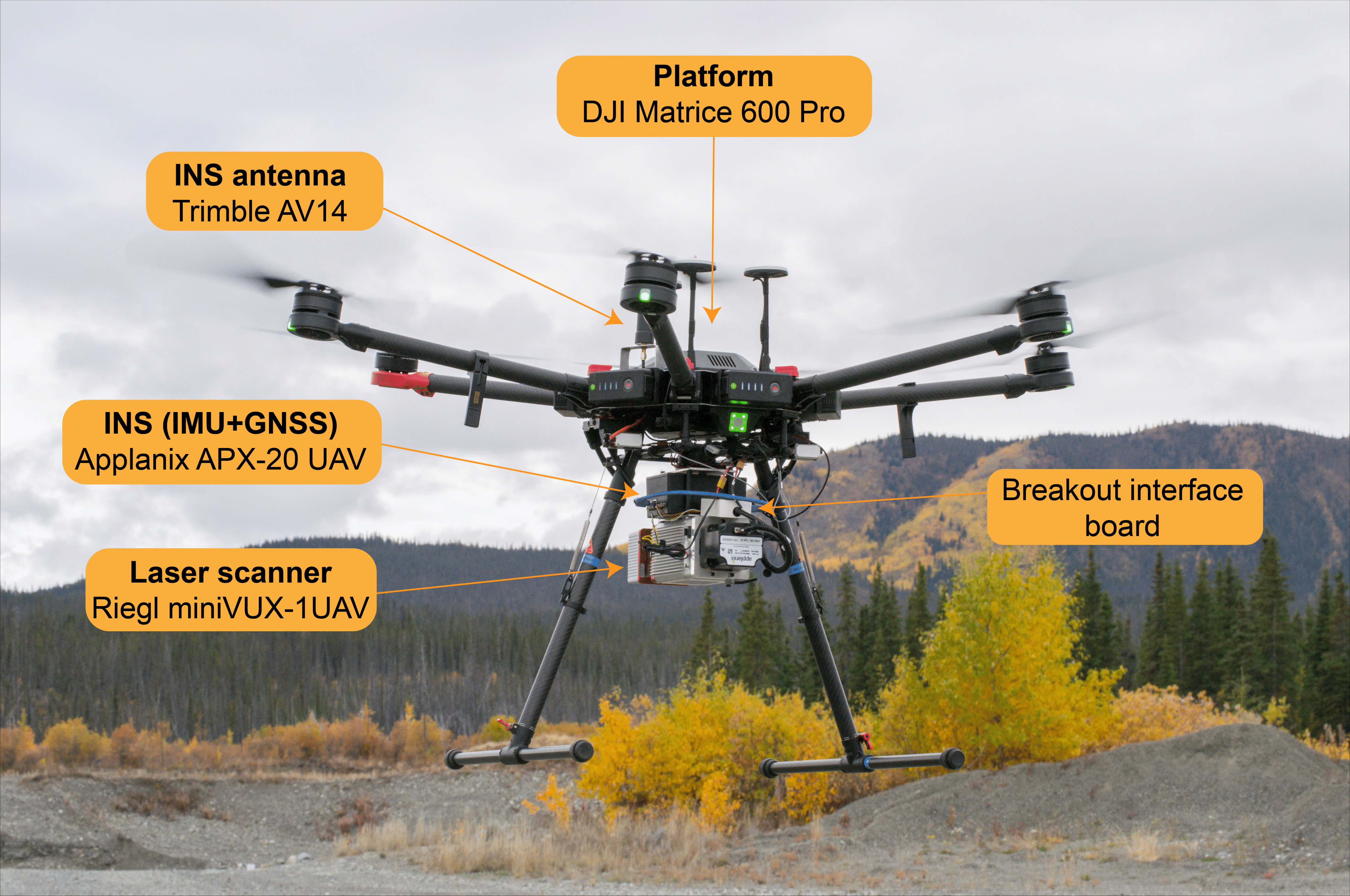
Lidar is a cornerstone remote sensing method to produce bare-earth elevation models of the ground surface, revealing geomorphic features produced by tectonic faults. While lidar is traditionally collected through airborne or terrestrial laser scanning techniques, collecting lidar via uncrewed aerial vehicles (UAV) aka drones is an emerging technique. Salomon et al. introduced a novel UAV laser scanning (ULS) or drone lidar system to study landforms produced by faults. They conducted four drone lidar surveys over recently faulted landscapes in western Canada, each with different vegetation types. They compared the UAV lidar to airborne lidar and Structure from Motion (SfM) surveys. While airborne lidar can cover much larger survey areas, the drone lidar surveys produced higher point cloud densities and better captured vegetative structure. The sub-50 cm resolution of digital terrain models produced by drone lidar surveys support identifying tectonic landforms that could otherwise be obscured with lower resolution data. Drone lidar is likely to complement airborne lidar, with its potential for rapid response and deployment, repeat mapping, and mapping beyond extents of existing airborne surveys.
The data used in this study were submitted to the OpenTopography Community Dataspace for publication.
- Data used:
- Publication: Salomon, G., Finley, T., Nissen, E., Stephen, R., & Menounos, B. (2024). Mapping fault geomorphology with drone-based lidar. Seismica, 3(1). https://doi.org/10.26443/seismica.v3i1.1186
 |
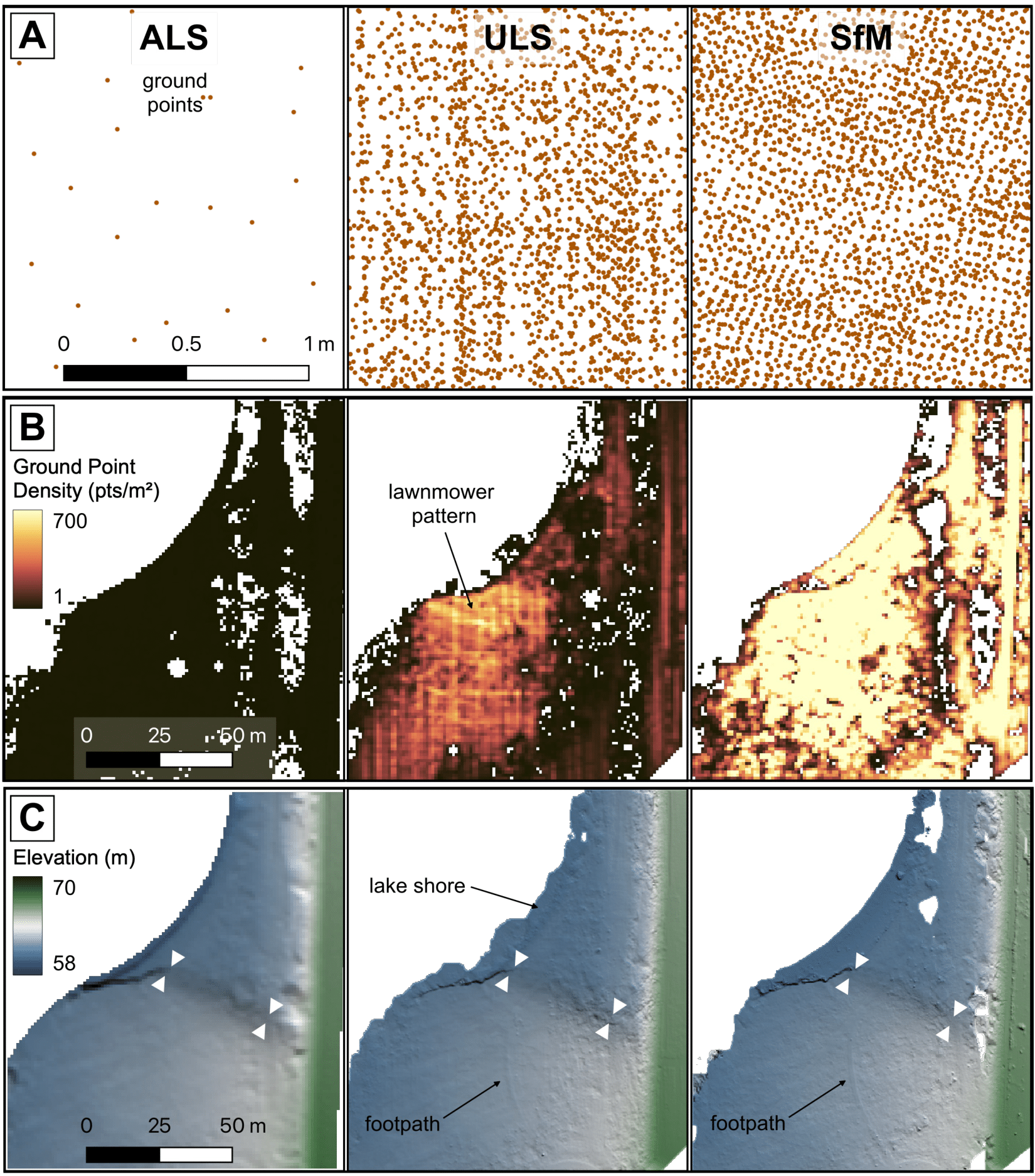 |
Drone lidar system used in the study (left) and comparison between airborne laser scanning (ALS), UAV laser scanning (ULS), and Structure from Motion (SfM) surveys from one of the study areas (right).
Snowmelt, topography, plants, and pollinators
Changes in climate impact plant-pollinator interactions. As climate warms, earlier snowmelt can shift seasonal ecological cycles and potentially disrupt plant and pollinator interactions. Rose-Person et al. conducted experiments to investigate the impacts on flowering and pollination from experimentally-driven earlier alpine snowmelt. Using test plots at Niwot Ridge, a long-term ecological research site in the Colorado Rocky Mountains, they found that plants were more abundant and flowered earlier following earlier snowmelt. However, earlier snowmelt did not impact how long the plants flowered for or how frequently pollinators visited, indicating that additional factors may drive plant-pollinator interactions under warmer climates. They found that the topography additionally influences smaller-scale patterns of snowmelt, as topography impacts snow depth and soil moisture. The topography therefore plays a role in driving variations in plant and pollinator interactions. It is thus important to understand how topography influences snow accumulation and seasonal plant cycles when predicting how alpine environments will be impacted by climate change.
- Publication: Rose-Person, A., Spasojevic, M. J., Forrester, C., Bowman, W. D., Suding, K. N., Oldfather, M. F., & Rafferty, N. E. (2024). Early snowmelt advances flowering phenology and disrupts the drivers of pollinator visitation in an alpine ecosystem. Alpine Botany, 1-10. https://doi.org/10.1007/s00035-024-00315-x
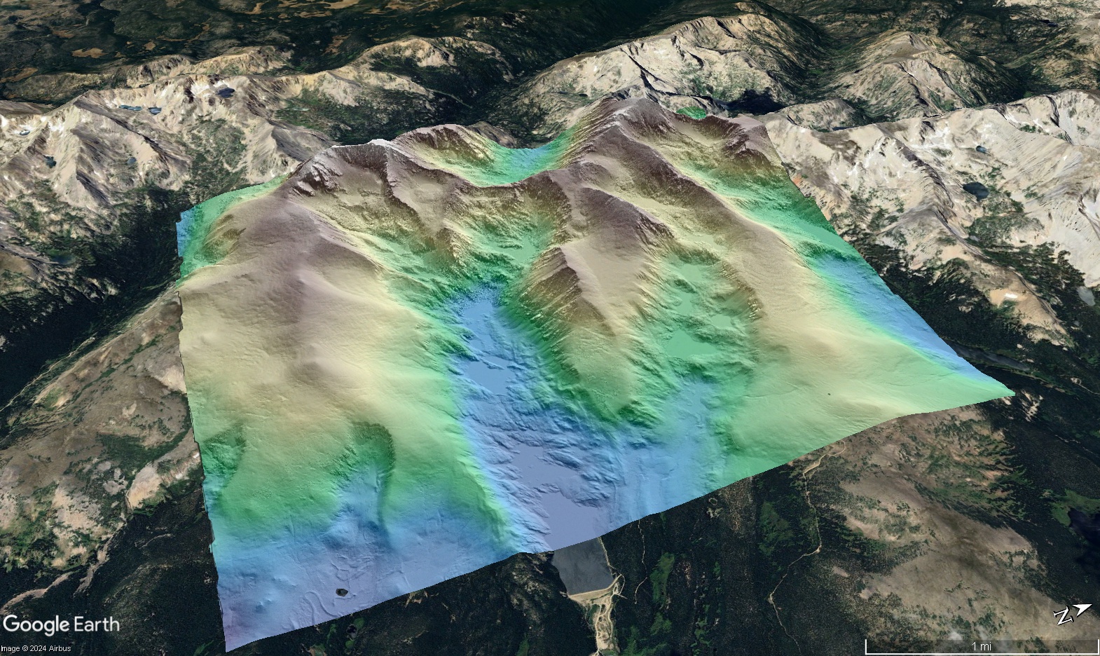
Hillshade colored by elevation of Niwot Ridge overlain on Google Earth imagery.
Remote sensing helps determine hurricane impact on vegetation and wildlife
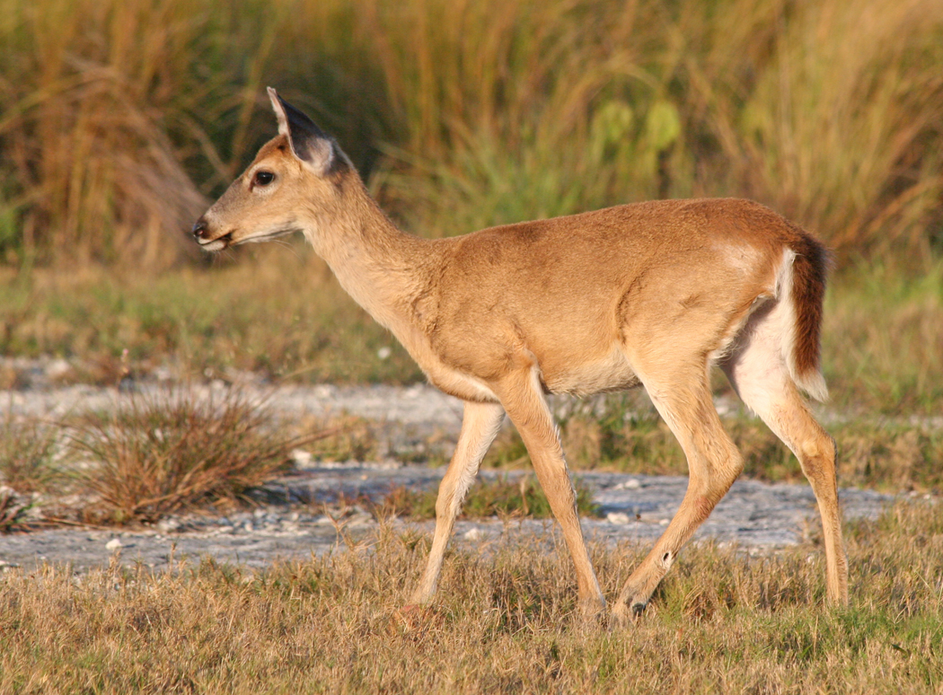
The low-lying Florida Keys are a vulnerable landscape during storms, as hurricanes can produce storm surges and cause severe damage to residential areas and wildlife habitats. Timely assessment of a storm’s impact on wildlife habitat can inform management and conservation strategies, such as for animals like the endangered Florida Key deer. Kim et al. used remote sensing data to detect vegetation changes following Hurricane Irma (September 2017) in the Lower Florida Keys and assess the storm’s impact on the Key deer habitat and population. They used aerial imagery and lidar data collected before and after the hurricane to determine land cover change. The Key deer prefer higher elevation areas such as pinelands and hammocks, and both of these land cover types were impacted by the storm. Based on the loss of the deer’s preferred vegetation areas, the study predicted a loss in the deer population, which was consistent with the post-storm field population survey. Aerial imagery and lidar data shows promise in providing a rapid and reliable assessment of changes in vulnerable wildlife populations following major storm events.
- Publication: Kim, J., Popescu, S. C., Lopez, R. R., Wu, X. B., & Silvy, N. J. (2024). Assessing hurricane impact on vegetation and endangered deer habitat using airborne lidar and multispectral images. Global Ecology and Conservation, 53, e03007. https://doi.org/https://doi.org/10.1016/j.gecco.2024.e03007
 |
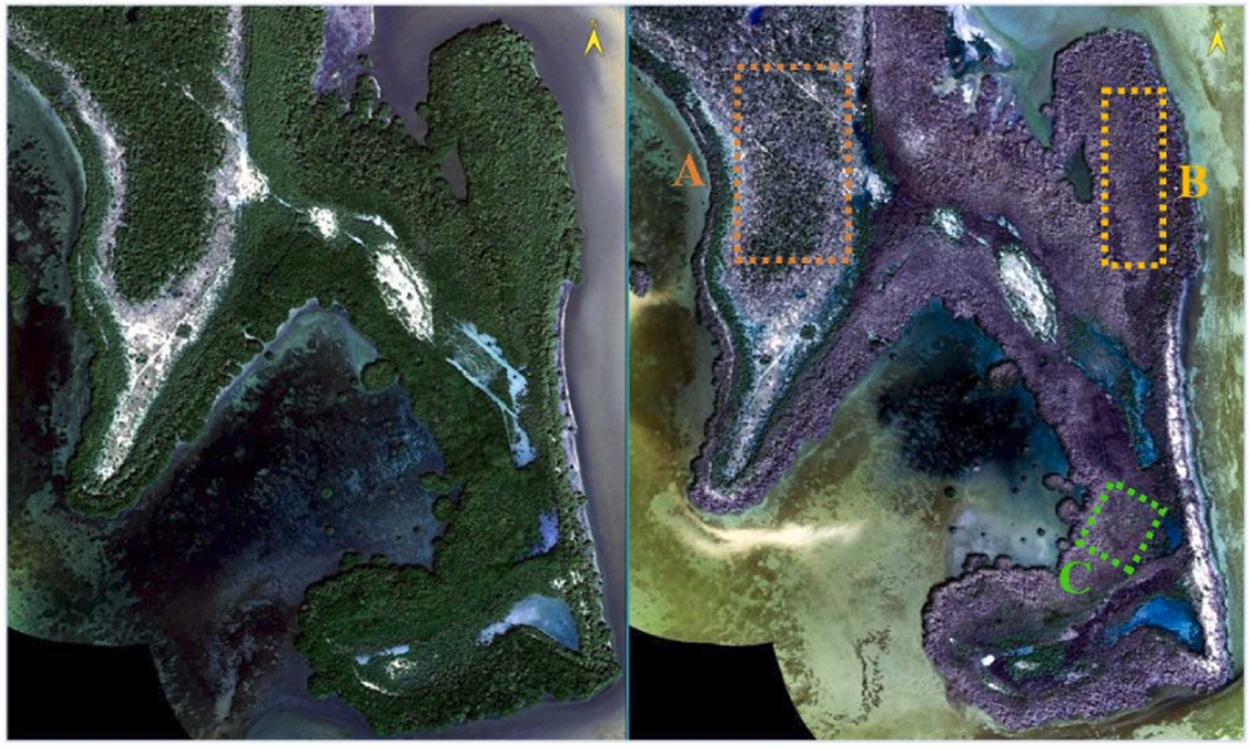 |
Key deer (left, photo: Joseph C Boone), aerial image comparison of No Name Key, Florida before and after hurricane Irma (right).
OpenTopography is supported by the U.S. National Science Foundation and facilitates access to topographic data for Earth and other scientific research and education. We closely track peer-reviewed publications that use OpenTopography data and services as they are an important measure of our impact.
Have a new paper out that uses data or services provided by OpenTopography and want us to highlight it in a future blog post? Drop us a note: info@opentopography.org
Using OpenTopography data in a publication? Follow our easy guide for citing data.
