By Tyler Scott and Chelsea Scott
OpenTopography has developed a treasure hunt that guides users as they explore several point cloud datasets hosted by OpenTopography. Point clouds are displayed with the Potree viewer, which is an open source point cloud renderer. In this exercise, users examine four point cloud datasets: The Kaibab Plateau and Granite Dells in Arizona, Salt Lake City, Utah and Boulder, Colorado. The treasure hunt asks participants to use different tools to visualize datasets with different attributes (such as color), make measurements (such as canyon width), and examine ground classifications.
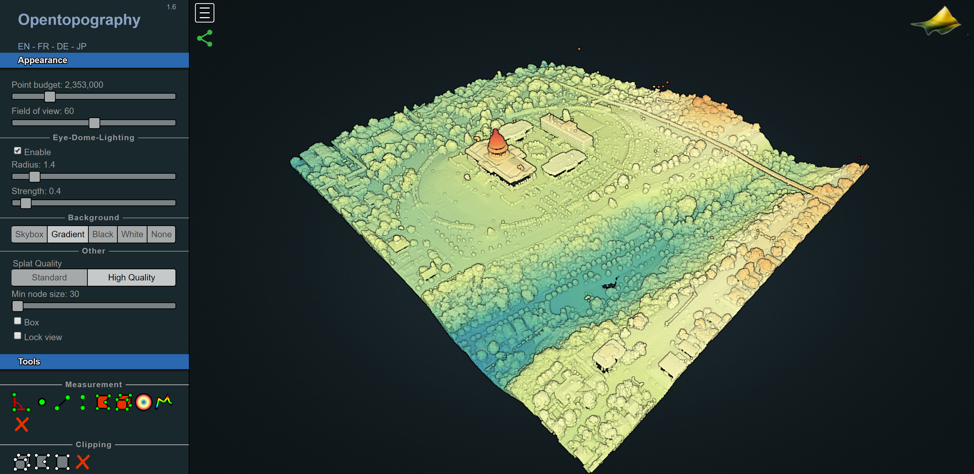
Potree visualization of the Utah State Capitol Building in Salt Lake City where the point cloud is colored by elevation. This airborne lidar dataset was acquired by the State of Utah in 2013 and 2014.
Exercise:
Treasure Hunt Hints
Treasure Hunt Answers
Sample Datasets in Potree: For use in the exercise. Open the link in a FireFox or Chrome internet browser.
Utah State Capitol Building in Salt Lake City
Boulder, CO
Granite Dells, AZ
Kaibab Plateau, AZ
Tutorial Video: