On-Demand Vertical Differencing of USGS 3DEP and NOAA Lidar Topography
This subscription provides access to lidar topography covering most of the US mainland, Hawaii, and territories as well as satellite data over the Arctic and Antarctic. This includes access to the USGS 3D Elevation Program (3DEP) and NOAA Coastal Lidar.
OpenTopography has expanded our on-demand vertical differencing (a.k.a. topographic change detection) tools to the U.S. Geological Survey’s (USGS) 3D Elevation Program (3DEP) and the National Oceanic and Atmospheric Administration (NOAA) coastal lidar collections. This update makes it possible to use OpenTopography's tools to compute topographic change for more than 20% of the contiguous United States that are covered by more than one high resolution lidar topographic dataset. These large-scale, approaching nationwide, collections of high resolution topographic data provide immense opportunities to explore how the Earth's surface, vegetation, and built environment has changed.
Topographic differencing is a technique for mapping changes in natural and anthropogenic landscapes. Vertical differencing is the subtraction of gridded elevation data (a.k.a. raster or digital elevation models (DEMs)). With the on-demand differencing tools that OpenTopography has released over the past several years, users can calculate and visualize surface change from a variety of tectonic, geomorphic, and anthropogenic processes including earthquakes, volcanic eruptions, river erosion, landslides, sand dune migration, urban development, and agriculture.
Users now have the ability to calculate and visualize changes to natural and anthropogenic environments with just a few mouse clicks using OpenTopography’s interactive web-based portal interfaces over 20% of the US’s lower 48. The expansion of vertical differencing to the USGS 3DEP and NOAA data collections is a natural expansion of our on-demand vertical capabilities previously only available for limited OT-hosted datasets.
A major challenge of accurate topographic differencing across multiple datasets is ensuring that all datasets are in the same horizontal and vertical coordinate reference system. Our topographic differencing workflow performs dynamic horizontal and vertical coordinate system reprojections based on metadata available from the USGS and NOAA.
OpenTopography has built educational materials on topographic differencing that include video tutorials, blog posts with differencing results, links to GitHub code repositories, and a differencing exercise designed for undergraduate courses.
We are initially offering this new functionality to the US academic research and education communities only. OpenTopography is primarily supported by the U.S. National Science Foundation Division of Earth Sciences and has limited resources to support on-demand computation. We are working with partners to make these invaluable public datasets and associated differencing tools more broadly available in the future.

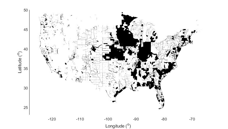
Spatial coverage of CONUS covered by two or more overlapping USGS 3DEP and NOAA lidar topography collections colored in black. We estimate that topographic differencing should be possible over ~20% for CONUS today.
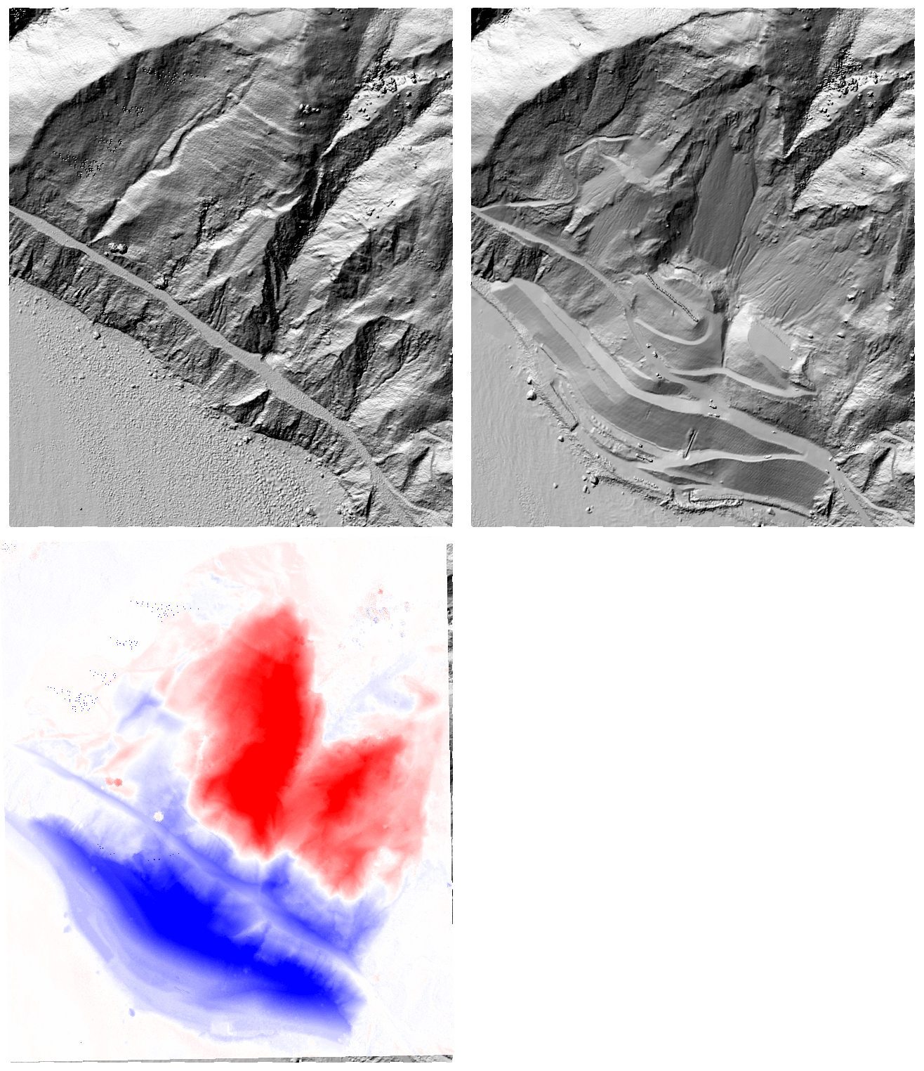
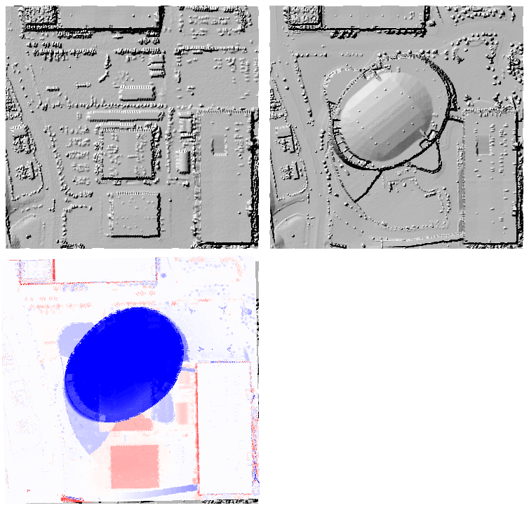
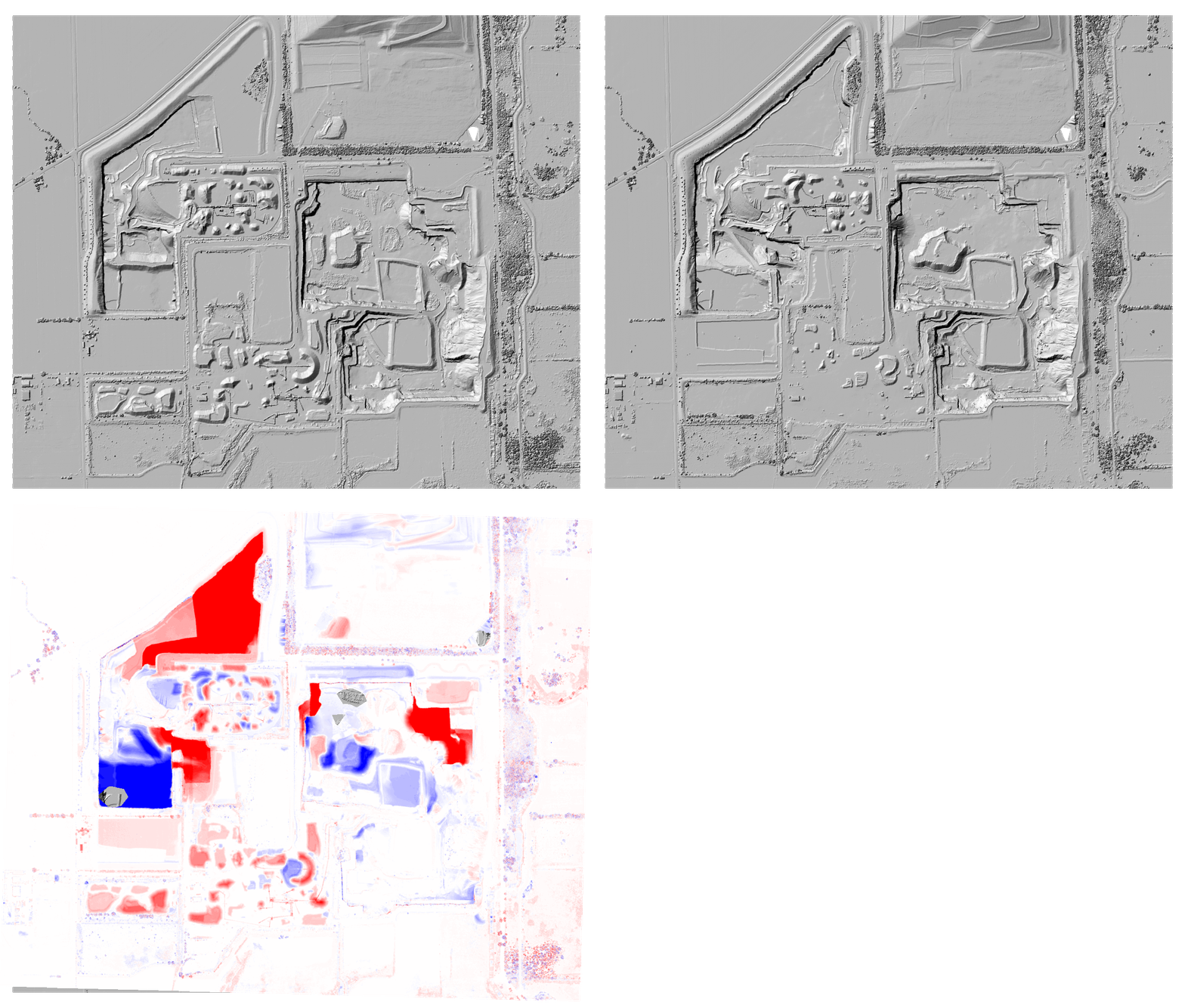
Examples of topographic differencing of USGS 3DEP topography: The differencing results are shown with a red-white-blue color scale. Erosion or downward change of the Earth’s surface is colored in red, while deposition or upward change is colored in blue.

2010 to 2018 topographic differencing showing the 2017 Mud Creek landslide along the Big Sur coastline of Central California located 140 km south of San Francisco, California. Click here to difference these datasets.

2010 to 2018 topographic differencing in Las Vegas, Nevada, showing the T-Mobile Arena that opened in 2016. Click here to difference these datasets.

2010-2017 topographic differencing of a quarry near Detroit, Michigan. Click here to difference these datasets.
Video demonstrating how to difference 3DEP and NOAA topography on OpenTopography:
