June 2025 Data Releases
Jul 2, 2025
OpenTopography provides easy, centralized access to a diverse collection of topographic data. We strive to simplify data discovery by providing a single, accessible platform that integrates data from academic, private, and federal sources, including the USGS 3D Elevation Program (3DEP) and NOAA Coastal Lidar. Below are highlights of datasets that became available on the OpenTopography platform in June 2025.
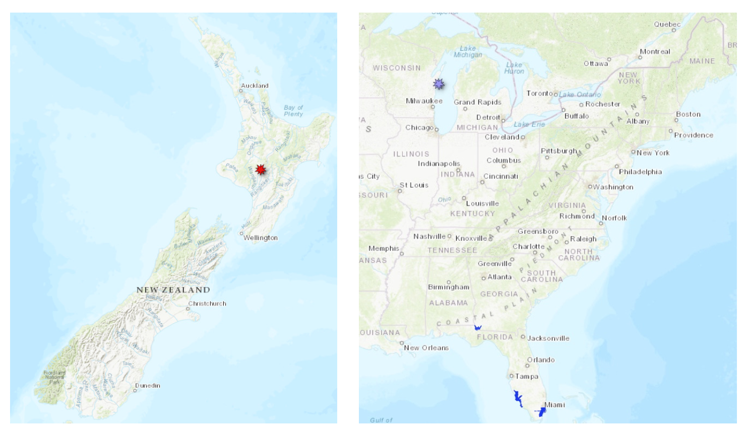
Left hand panel shows the location of new data over Mount Ruapehu, New Zealand. Right hand panel shows the location of a new Community Dataspace dataset in purple on the coast of Lake Michigan, and new NOAA datasets in Florida in blue
OpenTopography Community Dataspace Datasets
The OpenTopography Community Dataspace allows users who are producing small to moderate sized topographic datasets (with technologies such as lidar and photogrammetry) to archive their data with OpenTopography via a simple drag and drop user interface. This feature is designed to support data publication and citation, academic data reuse, and educational applications. Each submission is reviewed by OpenTopography staff and approved on a case-by-case basis. Datasets in the OT Dataspace receive a Digital Object Identifier (DOI) and are displayed on the OpenTopography Find Data Map so they are discoverable and downloadable alongside data hosted by OpenTopography. The Dataspace is meant to complement standard OpenTopography data hosting for larger datasets produced by our data provider partners.
New Community Dataspace data:
OpenTopography Hosted Datasets
The majority of datasets hosted directly by OpenTopography are free and open to all users. This month, as part of a PhD project focused on improving knowledge of the frequency and magnitude of postglacial lava flow eruptions, the Resilience to Nature’s Challenges program, in collaboration with the University of Canterbury and GNS Science, funded the acquisition of a high-resolution airborne lidar dataset over Mount Ruapehu, New Zealand (Aotearoa New Zealand). The lidar point cloud for this dataset is being made available to all OpenTopography users.
New OpenTopography hosted data:
NOAA Coastal Lidar Datasets
The NOAA Coastal Lidar Data is a collection of lidar projects from many different sources and agencies, geographically focused on the coastal areas of the United States of America. The data are stored in the Entwine Point Tile format, and hosted on Amazon as part of the AWS Public Dataset Program. Consistent with OpenTopography's mission of making high resolution topography data easier to discover and use, we provide a layer of value-added services that enable our users to subset, grid, download, and/or visualize any portion of the NOAA Coastal Lidar collection.
NOAA Digital Coast data is freely available to our core US academic user community (e.g. users who register with a .edu email domain). However, non-academics can access NOAA data, as well as all other restricted datasets, by signing up for OpenTopography Plus (OT+). OT+ is a subscription service that enables one-stop, easy-to-use access to the highest quality lidar topography for the US. For more details about OT+, or to sign up, see the OT+ signup page.
New NOAA Coastal Lidar data:
- 2022 NOAA NGS Pre-Hurricane Ian Topobathy Lidar: Naples to North Port, FL
- 2021 Miami-Dade ITD Lidar: Miami-Dade County, FL
- 2024 USACE NCMP Topographic Lidar: Lake Seminole (AL, FL, GA)
Sample Graphics From Data Released in June 2025
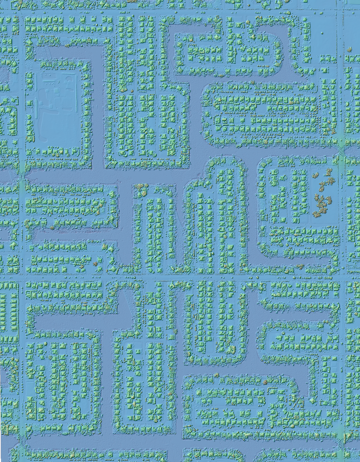
Colorized hillshade of homes along the canals in Cape Coral, Florida. Data Source: NOAA: 2022 NOAA NGS Pre-Hurricane Ian Topobathy Lidar: Naples to North Port, FL
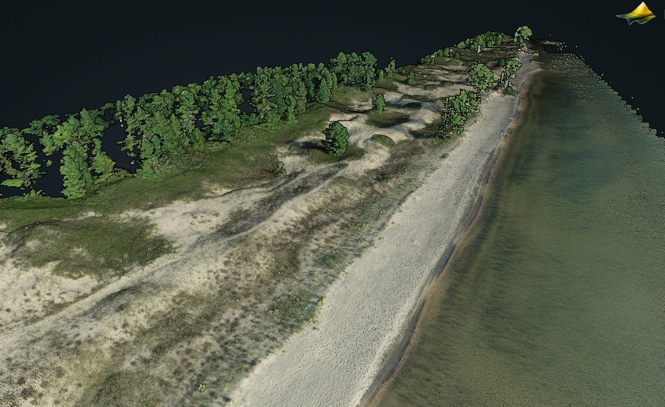
3D point cloud colored by RGB over a section of the Lake Michigan coastline. Data Source: Community Dataspace: Survey of Point Beach State Forest, Wisconsin, August 2021.
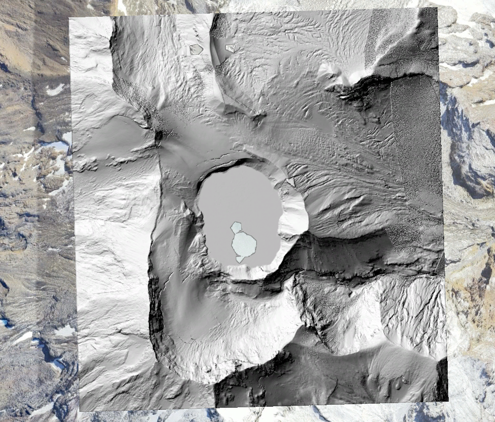
Hillshade of Mount Ruapehu crater lake draped on Google Earth imagery. Data Source: OT: Mount Ruapehu Summit Region and Rangataua Flows, New Zealand 2021
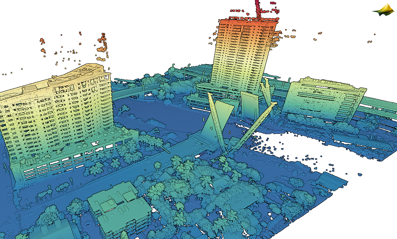
3D point cloud colored by elevation showing a draw bridge opening over the Miami River. Data Source: NOAA: 2021 Miami-Dade ITD Lidar: Miami-Dade County, FL