New NCALM datasets in California, and Montana now available
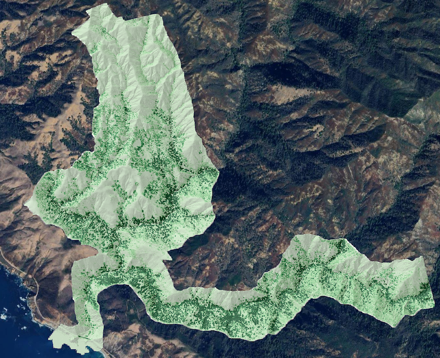
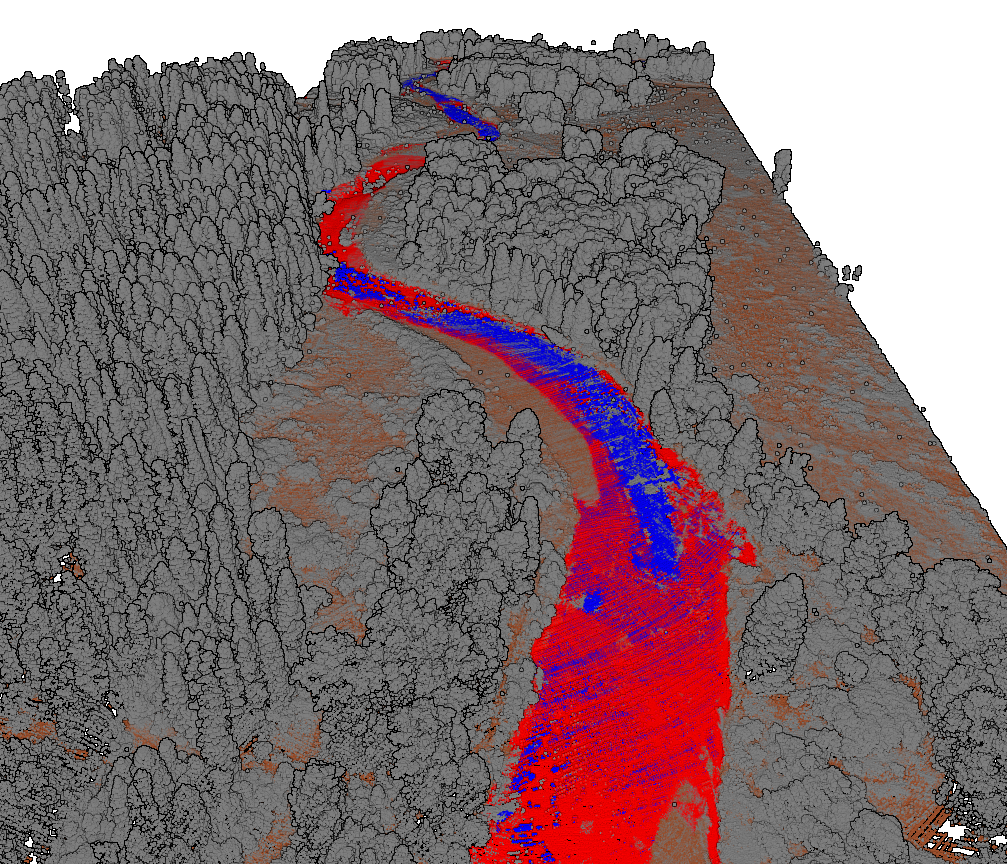
Three new NCALM (National Center for Airborne Laser Mapping) datasets are now available from OpenTopography. Two of these datasets examine hydrologic processes that affect channel evolution and dynamics in the western US. These include a dataset along the central coast of California which was collected for Telemak Olsen at Western Washington University. This dataset was collected to help quantify channel change in response to a post-fire debris flow in a steep coastal stream in Big Sur, California. In addition, in August 2022, a dataset was collected over the Swan and Middle Fork Flathead rivers in Montana for Anna Marshall at Colorado State University. This dataset was collected to help understand sources and functions of spatial heterogeneity in determining channel evolution of large mountain rivers.
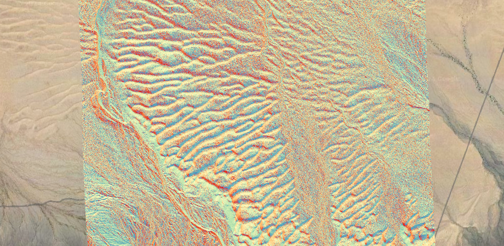
Finally, NCALM collected a dataset for M. Colin Marvin at the Stanford University to aid the quantitative characterization of dune-dune interactions in the Rice Valley dune field in the southeastern Mojave Desert.
NCALM is an NSF-funded center that supports the use of airborne laser mapping technology (a.k.a. lidar) in the scientific community and is jointly operated by the Department of Civil & Environmental Engineering, Cullen College of Engineering, University of Houston and the Department of Earth and Planetary Science, University of California, Berkeley. OpenTopography is the primary distributor of NCALM data.
Find the data here:
- Quantifying Channel Change in a Steep Coastal Stream, CA 2022
- Lidar Survey to Evaluate Spatial Heterogeneity and Channel Evolution, MT 2022
- Quantitative Characterization of Dune-Dune Interactions, CA 2022

Canopy height model (CHM) showing larger trees in dark green. CHM is overlaid on a hillshade of the digital terrain model (DTM) of the data. Background imagery provided by Google Earth. (Dataset: Quantifying Channel Change in a Steep Coastal Stream, CA 2022).

3D point cloud of lidar data over the Swan River in Montana. Data is colored by classification where red points are the water surface, and blue points are bathymetric returns. (Dataset: Lidar Survey to Evaluate Spatial Heterogeneity and Channel Evolution, MT 2022).

Plot of aspect of sand dunes in the Rice Valley Wilderness in southern California. Colorizing the data based on aspect helps to indicate the prevailing orientation of the dunes. (Dataset: Quantitative Characterization of Dune-Dune Interactions, CA 2022).
