
July 2026 Data Releases
Aug 17, 2026
This month's release brings new coverage across Europe, Central America, and the US. High-resolution, country-wide digital elevation models covering Norway, Finland, Switzerland, and Liechtenstein were added, offering national bare-earth and surface terrain coverage at 0.5–2 meter resolution. Numerous UAV-derived surveys over Guatemala were also contributed to OpenTopography's Community Dataspace program. In the US, several new USGS 3DEP lidar datasets were added in Arkansas, along with a NOAA-provided dataset over parts of Virginia.
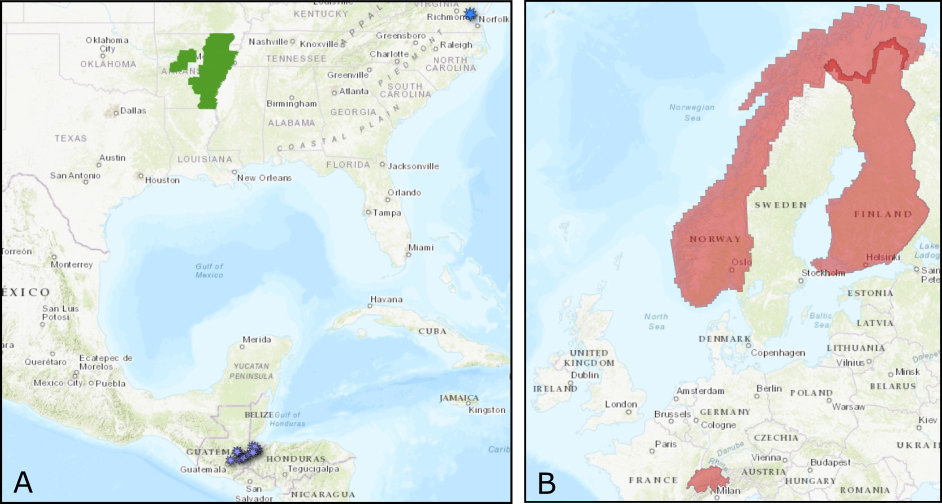
A. Locations of new USGS 3DEP datasets in Arkansas (green polygons), Community Dataspace datasets in Guatemala (purple markers), and NOAA datasets in Virginia (blue markers). B. Access to high resolution DEMs covering all of Norway, Finland, Switzerland, and Liechtenstein are now available.
OpenTopography Hosted Datasets
OpenTopography has added three national-scale elevation datasets to its collection: Norway 1 Meter Digital Elevation Models from Kartverket, the Finland 2 Meter Digital Elevation Model from Finland's National Land Survey, and the Switzerland 50 Centimeter Digital Elevation Models from swisstopo. Together these lidar-derived DTM/DSM products provide high-resolution terrain coverage for all three countries.
New OpenTopography data:
- Switzerland 50 Centimeter Digital Elevation Models
- Norway 1 Meter Digital Elevation Models
- Finland 2 Meter Digital Elevation Model
USGS 3D Elevation Program (3DEP) Datasets
The USGS is currently making 3DEP lidar point cloud data available via an Amazon Web Services (AWS) S3 Requester Pays Bucket, and as an AWS Public Dataset. To learn more about 3DEP and AWS see this USGS press release: USGS 3DEP Lidar Point Cloud Now Available as Amazon Public Dataset. Consistent with OpenTopography's mission of making high resolution topography data easier to discover and use, we provide a layer of value-added services that enable our users to subset, grid, download, and/or visualize any portion of the USGS 3DEP collection.
USGS 3DEP data is freely available to our core US academic user community (e.g. users who register with a .edu email domain). However, non-academics can access 3DEP data, as well as all other restricted datasets, by signing up for OpenTopography Plus (OT+). OT+ is a subscription service that enables one-stop, easy-to-use access to the highest quality lidar topography for the US. For more details about OT+, or to sign up, see the OT+ signup page.
New USGS 3DEP Datasets:
- AR Eastern 2 D23
- AR Eastern 3 D23
- AR Eastern 4 D23
- AR Eastern 5 D23
- AR Eastern 6 D23
- AR Eastern 7 D23
- AR Eastern 8 D23
- AR Eastern 9 D23
OpenTopography Community Dataspace Datasets
The OpenTopography Community Dataspace allows users who are producing small to moderate sized topographic datasets (with technologies such as lidar and photogrammetry) to archive their data with OpenTopography via a simple drag and drop user interface. This feature is designed to support data publication and citation, academic data reuse, and educational applications. Each submission is reviewed by OpenTopography staff and approved on a case-by-case basis. Datasets in the OT Dataspace receive a Digital Object Identifier (DOI) and are displayed on the OpenTopography Find Data Map so they are discoverable and downloadable alongside data hosted by OpenTopography. The Dataspace is meant to complement standard OpenTopography data hosting for larger datasets produced by our data provider partners.
New Community Dataspace data:
- UAV Lidar Survey near Rio Tambor, Guatemala, January 2024
- UAV Lidar Survey near Gualan, Guatemala, January 2024
- UAV Lidar Survey of Museo Quirigua, Guatemala, January 2024
- UAV Lidar Survey 2 near Santa Catalina La Tinta, Guatemala, January 2024
- UAV Lidar Survey of a Mellon Farm, near Estanzuela, Guatemala, January 2024
- UAV Lidar Survey 1 near Santa Catalina La Tinta, Guatemala, January 2024
- UAV Lidar Survey near Finca del Eden, Guatemala, January 2024
- UAV Lidar Survey near Carillabas, Guatemala, January 2024
- UAV Lidar Survey near La Laguna, Guatemala, January 2024
- UAV SfM Survey of a Ranch near Costa Del Lago Cocales, Guatemala, 2024
NOAA Coastal Lidar Datasets
The NOAA Coastal Lidar Data is a collection of lidar projects from many different sources and agencies, geographically focused on the coastal areas of the United States of America. The data are stored in the Entwine Point Tile format, and hosted on Amazon as part of the AWS Public Dataset Program. Consistent with OpenTopography's mission of making high resolution topography data easier to discover and use, we provide a layer of value-added services that enable our users to subset, grid, download, and/or visualize any portion of the NOAA Coastal Lidar collection.
NOAA Digital Coast data is freely available to our core US academic user community (e.g. users who register with a .edu email domain). However, non-academics can access NOAA data, as well as all other restricted datasets, by signing up for OpenTopography Plus (OT+). OT+ is a subscription service that enables one-stop, easy-to-use access to the highest quality lidar topography for the US. For more details about OT+, or to sign up, see the OT+ signup page.
New NOAA Coastal Lidar data:
Sample Graphics From Data Released in July 2026
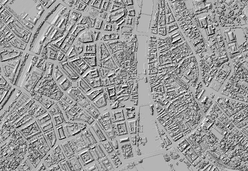
A 50 cm hillshade of a DSM over a section of Zurich, Switzerland. Data Source: OpenTopography: Switzerland 50 Centimeter Digital Elevation Models.
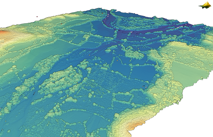
3D point cloud colored by elevation of Rio Tambor, Guatemala. Data Source: OT CDS: UAV Lidar Survey near Rio Tambor, Guatemala, January 2024
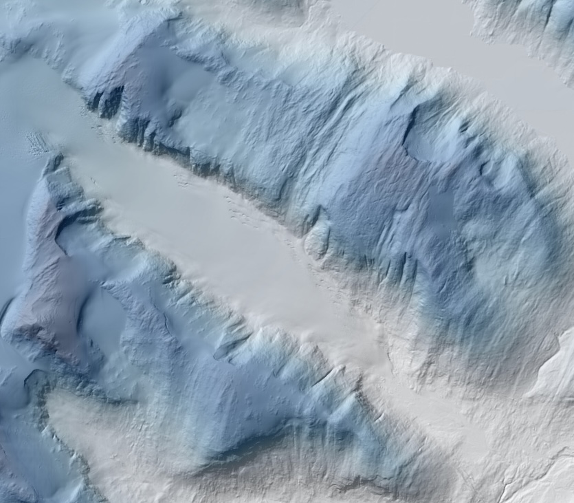
A hillshade draped on a Digital Surface Model (DSM) of an alpine glacier in Norway. Darker blues are higher elevations. OpenTopography: Norway 1 Meter Digital Elevation Models.
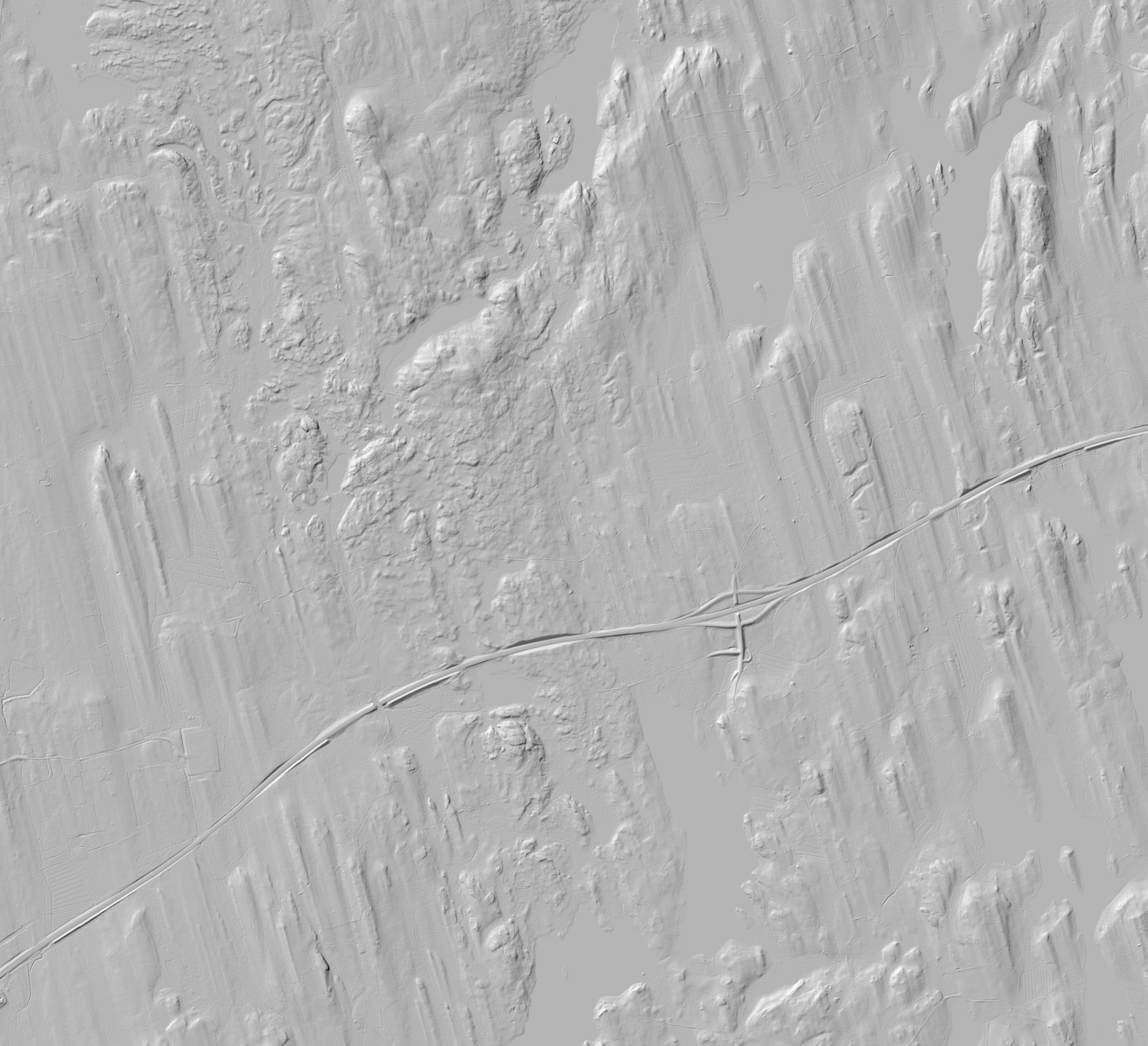
A hillshade of a DTM of drumlins in southern Finland. OpenTopography: Finland 2 Meter Digital Elevation Model.
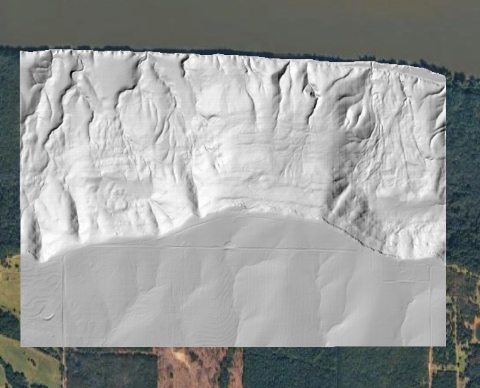
Hillshade of a plateau over the Arkansas River. Data Source: USGS 3DEP Lidar: AR Eastern 3 D23.